
For those that don’t know me, I’m Capt. Eric “Cornmeal” Ellison, and I run Capt. Cornmeal Charters out of Orange, Tx.
I’m experienced on the local waterways, and pride myself in being a safe, certified USCG Capt.. Even the most experienced boaters can have a dangerous moment, and I’d like to share mine with you, in hopes it will help one of our readers out there.
On Thursday, 05/19/2016, I left the Orange Boating Club at safe light without expecting I’d be mere inches from complete disaster in a few hours. I had a long-time friend, and fellow Capt., Jerome McKown aboard The CORNMEAL for some scout fishing for an upcoming tournament we are fishing.
We had a great time that morning sight fishing to some redfish along some back ponds around the marshes. As the morning wore on, we continued to do some scout fishing around the Conway Bayou area, just off the Sabine River. We also were very mindful of a line of storms that was quickly approaching our area. A decision was made (all be it not a hard one) that we needed to get The CORNMEAL back to the ramp, and quickly.
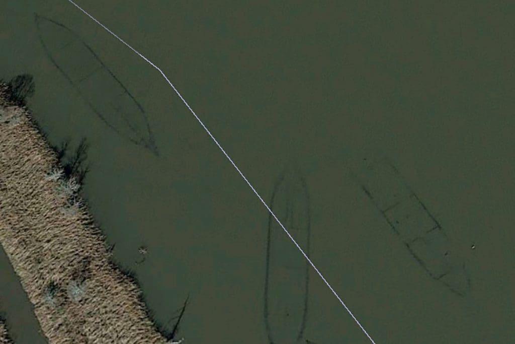
For the readers unfamiliar with the area of the Sabine River, near Conway’s Bayou, there is a ship graveyard from unused WWI ships (yes, the First World War) that were intentionally sank in the river in this area in late 1918, early 1919. For your reading pleasure, please go to the following link: www.geocities.ws/pentagon/quarters/4054/conwaybayou.html
“Wrecks of Conway Bayou Sabine River” ~prepared by Texas Archeological Studies Association (director- Bruce M. Lockett).
Like I said earlier, I am familiar with the waterway of the Sabine River in the “Conway’s Cut.” I know there are sunken ships which are visible at low tide, and slightly under the water at high tide. There are marker pvc pipes near these wrecks to give boaters a visual reminder of the underwater obstructions.
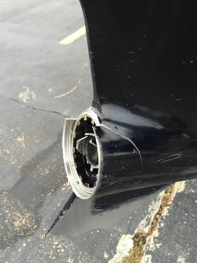
For whatever reason, as I headed south in the Conway’s Cut, I passed one of the pvc markers on my port side. I knew immediately that I was on the wrong side of the marker. Sure enough, while cruising at 53 mph… Thump! Yep, I hit a sunken ship that has been in the same spot for some 97 years! Luckily for us, we were not thrown out of the boat, or the bottom of he boat damaged, but the 225 YAMAHA SHO had seen better days. The entire prop, hub, and half of the skag was missing. I was dead in the water, with only a trolling motor slowly guiding me back to the dock. As luck would have it, Capt. Dickie Colburn was still at the Orange Boating Club, finishing up cleaning fish for his clients, and was able to tow me back in the rest of the way.
Even an experienced boater can have an accident on the water. Always make sure to research the water you intend to be on, wear your PFD, kill switch, and BE CAREFUL. For those wanting to mark the ship I hit in the Conway Cut, it is located at: 30*03’50.91″N
93*42’01.65″W