
Coastal Mapping Systems
USING THE BEST SYSTEMS can help you cruise directly to the hotspots—and then catch more fish.
Any discussion of coastal mapping for anglers should certainly start with the Texas Lakes & Bays Atlas. We’ve been publishing this book for 32 years. It covers more than 3,000 fishing hotspots in 63 lakes and coastal bays
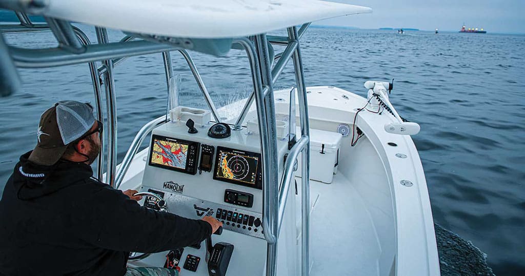
Although the GPS coordinates, tips, and detailed contour maps are invaluable to anglers of all kinds, the conversation certainly does not end there. The digital mapping system in the MFD at your boat’s helm is also a critical component to locating hotspots, cruising directly to them, and identifying similar benthic geography in an area that potentially holds fish.
Mapping Matters
Marine chartography has long been dominated by two players, Navionics and C-Map. They are still the mapping providers of choice of all major electronics manufacturers. In recent years, however, electronics manufacturers have also made an investment in developing their own proprietary mapping systems.
Garmin has developed BlueChart g3 and g3 Vision maps. These maps include bathymetric contour detail to one foot, auto-guidance ability, depth and shoal water shading, and some high-resolution relief shading via ActiveCaptain. The g3 Vision mapping also includes high-resolution satellite photography, aerial photography, and 3-D “fisheye” underwater perspectives.
Humminbird recently entered the proprietary saltwater mapping game with their CoastMaster charts, which won the 2020 ICAST award for Best of Electronics. CoastMaster charts are an add-on compatible with Helix G3/G3N and Solix models, with contour data to one foot, depth and shallows highlighting, and customizable fishing and navigation presets.
These charts also have several unusual fishing-specific features that will prove valuable for shallow water anglers casting along the coast. This includes the ability to color-shade areas that will be above water at low tide but submerged at high tide, and a water level offset that synchronizes contours and shorelines with current tidal levels.
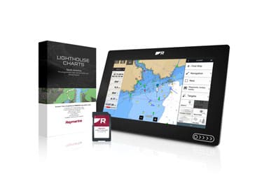
Raymarine offers LightHouse charts and LightHouse Premium. This feature adds high-resolution satellite imagery and points-of-interest intel with data on marinas, fuel docks, and the like. This will come in handy during road trips to unfamiliar waters. Contours can be displayed up to that same epic one-foot detail, and there are “verified” fishing hotspots included on the maps.
Most of these systems depend on a mix of different databases, usually starting with NOAA soundings and building from there with proprietary information. In some cases, data is sourced from charter captains or even crowd-sourced information.
Some additional mapping system providers, however, take a different tack. CMORE Mapping is compatible with many Navico brand, Raymarine, Mercury VesselView, and Furuno products. It produces bathymetry for limited geographical areas including some Gulf waters.
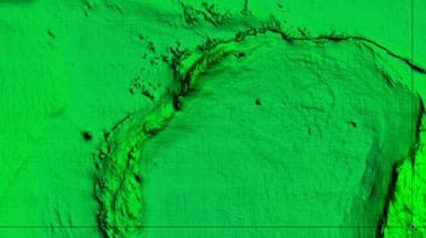
These color-shaded maps with one meter resolution feature data gathered via full-coverage echosounder surveys with no interpolation. This produces mapping with far fewer errors and significantly more accurate detail than the norm.
However, coverage areas are limited. Most of the West Gulf bathymetry and much of the Eastern Gulf is offshore waters, only, and the price is steep at $700 for a chart card.
Another on-the-water data gatherer is StrikeLines, which details a wider swath of Texas’s inshore and coastal waters and a large portion of offshore water. However, it still has gaps in the coverage areas.
StrikeLines chartography is compatible with many Navico, Raymarine, and Mercury VesselView units. It can also be utilized on Android and iOS devices, and is available both in downloadable and MicroSD chart card forms. Pricing is a bit more palatable, too, at $199 to $449.
It’s important to remember that systems like CMORE and StrikeLines are constantly updated and expanded as more and more mapping surveys get done. If the areas you fish most often aren’t yet covered, it’s worth revisiting in the future.
Strikelines also offers some spectacular 4K aerial imaging with clarity good enough to pick out features like sandbars and weedbeds in the shallows, but the coverage for 4K currently runs from Florida through Louisiana. We certainly hope these folks plan on working their way west in the near future.
Delivering the Data
If you look at all the systems and the perks and features, they offer, you wouldn’t be wrong in thinking that all of them deliver a whole lot more than the digital mapping systems we used just a few years ago. What tops them all, however, is the ability to create your own bathymetric mapping.
While it’s often limited to midrange and higher units in the model lines, all of the major manufacturer’s modern MFDs now include the ability to self-chart. Lowrance calls it Genesis, Raymarine calls it RealBathy, Humminbird calls it AutoChart Live, and Garmin uses the moniker Quickdraw Contours. Each of these systems is a bit different, but the bottom line remains the same. Your own sonar and GPS work together to collect pings and position data, allowing you to draw your own digital charts as you fish.
In the long run, this may be the most important mapping capability of them all. When considering digital chartography, you have to recognize at the outset that there’s no such thing as an error-free data pool. As great as all these mapping systems may be, there will be times when the chartplotter says you’re parked over a tall hump or reef that comes up to 20 feet, and the fishfinder screen reads a steady 50 feet. If you have an MFD with digital maps you already know this—we’ve all been there. Self-charting, however, allows you to gather 100 percent accurate, real-time, interpolation-free data for the waters you personally fish.
What about identifying new and faraway hotspots? Self-mapping may not help in that regard, but stock chartography is almost always good enough to get you into the general vicinity of a reef, wreck, or shelf, and with a few passes you should be able to locate what you’re looking for, record on-site data, and then access that data forever, at a glance.
Mobile Mapping
If you don’t have an MFD capable of enjoying mapping features such as those we’ve described here, you can still get into the game with a cell phone or tablet. Navionics and C-Map both offer apps that allow you to essentially turn your Android or iOS device into a chartplotter that displays their mapping systems.
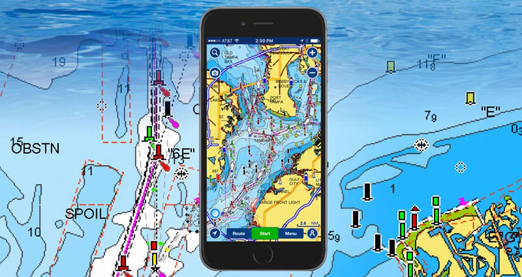
The Navionics app offers a rather amazingly comprehensive set of features, including high-resolution bathymetry with one-foot contours, user-selected color depth shading, and dock-to-dock auto-routing. In fact, if your fishfinder is WiFi enabled you can even pull data from it to enjoy SonarChart Live, the Navionics version of self-mapping. In many cases older MFDs have WiFi, but not the ability to self-chart. Using the Navionics app and your phone allows you to tap into this ability without having to make an expensive electronics upgrade. A one-year subscription goes for a mere $14.99. C-Map’s app is free and has similar functionality, but without the self-charting abilities or the ability to download maps and use them offline unless you upgrade to the Premium version ($25.99/year).
So, which of these systems is “best?” The truth of the matter is that most anglers will have the option of using Navionics or C-Map, but beyond that, will be limited by the brand of MFD sitting at the helm of their boat. The good news is that all of these systems offer you data and detail that’s light years ahead of what you’d have seen on the screen just a few short years ago. Whichever mapping system you might employ, one thing is for sure: learn how to use it effectively, and it will help you become a more effective angler.
Email Lenny Rudow at ContactUs@fishgame.com
[button title=”Return to CONTENTS Page” link=”https://fishgame.com/2105-may-june-2021-issue/” target=”” align=”” icon=”” icon_position=”” color=”” font_color=”” size=”2″ full_width=”” class=”” download=”” rel=”” onclick=””]