
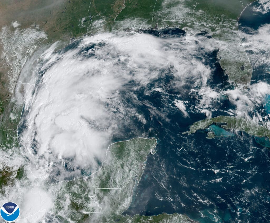
By the time this story reaches you Tropical Storm Nicholas will have made landfall somewhere on the Middle Texas Coast.
It is expected to produce a considerable storm surge for a storm of its size but the biggest concern is torrential rain that could impact the Texas Gulf Coast, East Texas and even Louisiana.

This area of heavier rain will follow the track of Nicholas across eastern Texas and into Louisiana through Tuesday into early Wednesday according to officials with The Weather Channel.
Expect a major threat of flash flooding near the Gulf Coast from Texas to southwest Louisiana through the first half of the week. Rainfall rates could be 2 inches per hour or greater at times in some locations.
Nicholas could produce the following rainfall totals along its path through midweek, according to NOAA’s Weather Prediction Center.
-8 to 16 inches (locally up to 20 inches) across parts of the middle and upper Texas coast, possibly including Houston.
-5 to 10 inches across the rest of coastal Texas into southwest Louisiana.
Whenever a tropical cyclone (a tropical depression, tropical storm, or hurricane) or a subtropical storm has formed in the Atlantic or eastern North Pacific, the NOAA National Hurricane Center (NHC) issues tropical cyclone advisory products at least every 6 hours at 5 am, 11 am, 5 pm, and 11 pm EDT. Similarly, the Central Pacific Hurricane Center (CPHC) issues tropical cyclone advisory products for the central North Pacific at least every 6 hours at 5 am, 11 am, 5 pm, and 11 pm HST. When coastal tropical storm or hurricane watches or warnings are in effect, the NHC and CPHC issue Tropical Cyclone Public advisories every 3 hours. You can find these products on www.hurricanes.gov for the Atlantic and eastern North Pacific or www.weather.gov/cphc for the Central Pacific; on TV, radio, and cell phones; and NOAA Weather Radio. Information on NWS tropical cyclone watch, warning, advisory, and outlook products is detailed below. For more details on all NHC products, see the National Hurricane Center Product User’s Guide. Storm information and forecasts specific to your local area can be found from you local Weather Forecast Office (WFO) through www.weather.gov.
–Warnings
Listen closely to instructions from local officials on TV, radio, cell phones or other computers for instructions from local officials.Evacuate immediately if told to do so.
- Storm Surge Warning: There is a danger of life-threatening inundation from rising water moving inland from the shoreline somewhere within the specified area, generally within 36 hours. If you are under a storm surge warning, check for evacuation orders from your local officials.
- Hurricane Warning: Hurricane conditions (sustained winds of 74 mph or greater) are expected somewhere within the specified area. NHC issues a hurricane warning 36 hours in advance of tropical storm-force winds to give you time to complete your preparations. All preparations should be complete. Evacuate immediately if so ordered.
- Tropical Storm Warning: Tropical storm conditions (sustained winds of 39 to 73 mph) are expected within your area within 36 hours.
- Extreme Wind Warning: Extreme sustained winds of a major hurricane (115 mph or greater), usually associated with the eyewall, are expected to begin within an hour. Take immediate shelter in the interior portion of a well-built structure.
Please note that hurricane and tropical storm watches and warnings for winds on land as well as storm surge watches and warnings can be issued for storms that the NWS believes will become tropical cyclones but have not yet attained all of the characteristics of a tropical cyclone (i.e., a closed low-level circulation, sustained thunderstorm activity, etc.). In these cases, the forecast conditions on land warrant alerting the public. These storms are referred to as “potential tropical cyclones” by the NWS.
Hurricane, tropical storm, and storm surge watches and warnings can also be issued for storms that have lost some or all of their tropical cyclone characteristics, but continue to produce dangerous conditions. These storms are called “post-tropical cyclones” by the NWS.